
NASA-ISRO NISAR satellite to launch on July 30 aboard GSLV-F16, will deliver real-time climate and disaster data |
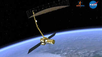

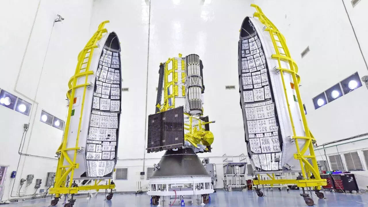
In a landmark step for global Earth observation, the NASA-ISRO Synthetic Aperture Radar (NISAR) satellite is set to launch on July 30, 2025, aboard India’s GSLV-F16 rocket from the Satish Dhawan Space Centre in Sriharikota. The satellite, jointly developed by the Indian Space Research Organisation (ISRO) and the US National Aeronautics and Space Administration (NASA), is designed to provide high-resolution, all-weather, day-and-night imaging of Earth.Weighing 2,392 kg and powered by dual-frequency radar systems (L-band and S-band), NISAR will offer near real-time data on disasters, climate shifts, and ecological changes. The mission is expected to serve not only India and the US, but also aid global decision-making and emergency response efforts.
NISAR satellite: A milestone in Indo-US space collaboration
NISAR (NASA-ISRO Synthetic Aperture Radar) marks the first major Earth observation satellite to be jointly developed by the United States and India. The mission is a testament to a decade-long strategic partnership between NASA and ISRO, showcasing how international cooperation can produce cutting-edge science with global impact. The satellite combines NASA’s L-band radar, capable of penetrating vegetation and forest canopies, with ISRO’s S-band radar, better suited for monitoring soil and surface changes.This dual-frequency capability gives NISAR a unique edge in detecting a wide range of Earth phenomena with unparalleled accuracy.NISAR is not just another Earth observation satellite — it is designed to revolutionize how we understand and respond to environmental and geological changes. Its ability to deliver high-resolution, all-weather, day-and-night imagery means it can monitor Earth’s surface continuously, regardless of cloud cover or lighting conditions. With a swath width of 242 kilometers and powerful SweepSAR technology, NISAR will detect minute surface deformations as small as a centimeter.This makes it a game-changer in areas like:
- Disaster Management: NISAR can provide near real-time data on earthquakes, landslides, floods, volcanic activity, and other natural disasters. Emergency responders and authorities can use this data to map damage, track disaster progression, and allocate relief resources more efficiently.
- Climate Monitoring: The satellite will track glacial melt, sea-level rise, soil moisture, and permafrost degradation, providing vital input to climate models. This will help scientists better understand the pace of global warming and its regional effects.
- Agricultural Forecasting: NISAR can monitor crop growth, soil displacement, irrigation levels, and land use changes. This will allow governments to predict harvest yields, manage water usage, and detect signs of drought or land degradation early on.
- Urban and Infrastructure Planning: By measuring land subsidence and structural shifts, especially in rapidly growing cities, NISAR will aid in the monitoring of dams, roads, bridges, and buildings — reducing risks of collapses or infrastructure failure.
- Forest and Biodiversity Conservation: Its ability to penetrate dense vegetation makes NISAR a powerful tool in mapping deforestation, forest health, and habitat encroachment. Conservationists can use the data to track illegal logging and protect endangered ecosystems.
The mission reflects India’s emergence as a reliable partner in high-end space research and underscores the potential of science diplomacy. With NISAR, both India and the US are set to offer open-access satellite data, empowering not just national agencies, but also scientists, researchers, and governments worldwide to better respond to pressing planetary challenges.
Democratizing access to satellite data
ISRO and NASA have committed to making NISAR’s data freely accessible within one to two days of capture, and in near real-time for urgent events. This open-data policy will be especially valuable for developing nations that lack access to high-end Earth observation systems, enabling better climate planning, resource management, and disaster preparedness.The mission also marks the first time a GSLV rocket will place a satellite into sun-synchronous polar orbit, a technical milestone for ISRO. This achievement expands India’s launch capabilities and opens new pathways for supporting diverse international satellite missions in the future.Union Minister Jitendra Singh hailed the mission as symbolic of India’s transition from utility-based space programs to global scientific leadership. As climate change accelerates, satellites like NISAR are becoming essential for policy intervention, risk assessment, and sustainability.
A $1.5 billion mission for global good
Developed over more than a decade with joint funding exceeding $1.5 billion, the NISAR mission is expected to have a transformative impact on how the world observes and responds to Earth’s changing dynamics. With launch preparations underway, the mission stands as a scientific handshake between two spacefaring democracies for the benefit of the planet.