Karnataka government geotags over 31,000 waterbodies in restoration effort | India News
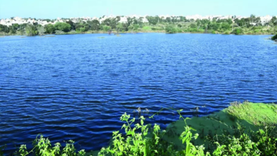

BENGALURU: In a move to safeguard its water resources and protect lakes, the Karnataka govt launched a project involving the geotagging of lakes in March 2024. The project, taken up by the department of minor irrigation and groundwater development in collaboration with the department of survey, settlement and land records, seeks to geotag all 41,875 waterbodies in the state.As of April 2025, as many as 31,033 waterbodies were geotagged. Locals and panchayats are pitching in, turning conservation into a community mission. With this, the govt can track real-time updates, including water flow and encroachments.Till April, the state had surveyed and mapped 34,651 lakes spanning 7.7 lakh acres. In the process, it identified 42,678 acres of lake encroachment; of this, 28,750 acres have been cleared and restored, while the remaining are in the process of being recovered. Among the districts, Hassan has the highest number of geotagged waterbodies so far, while Ballari has the least. Community participation has played a key role in ensuring the project’s progress, with gram panchayats helping in identifying lake boundaries, resolving local disputes and validating field data.Legal enforcement has also been made easier through geotagging. When encroachments are detected using data, the authorities concerned fine those responsible. The geotagged data is being used to support drought resilience and groundwater recharge planning, and aligns with the Karnataka State Action Plan on Climate Change, the Bengaluru Climate Action & Resilience Plan, and World Bank’s water resilience project. Officials say this integrated approach will help the state strengthen flood-control measures, improve water storage, and secure the long-term water availability across the urban & rural areas across the state.